Wissenswertes zum Taxon (Art, Unterart, Varietät...)
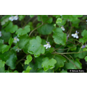
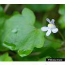
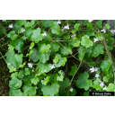
Cymbalaria muralis P. Gaertn., B. Mey. & Scherb. 1800
Plantaginaceae
- Wegerichgewächse (APG IV)Zimbel-Mauerkraut
Taxonkonzept: Schmeil-Fitschen 2019
Verbreitung: Europa: Schweiz, Italien, Sizilien, Slowenien, Kroatien, Bosnien, Montenegro; eingebürgert in Britische Inseln, Skandinavien, Frankreich, Mitteleuropa, östl. Mitteleuropa, Iberische Halbinsel
Größe: 0 (m)
Blütezeit: VI - IX
Cymbalaria muralis P. Gaertn., B. Mey. & Scherb. - Accepted: Cymbalaria muralis P. Gaertn., B. Mey. & Scherb. bei The Plant List (2014), version 1.1; Familie: Plantaginaceae (APG III)Cymbalaria muralis P. Gaertn., B. Mey. & Scherb. - Accepted: Cymbalaria muralis P. Gaertn., B. Mey. & Scherb. bei The Plant List (2014), version 1.1; Familie: Plantaginaceae (APG IV)
Erhardt, W., Götz, E., Bödeker, N. & Seybold, S. (2008): Der große Zander. Enzyklopädie der Pflanzennamen. Band 2. Arten und Sorten. Eugen Ulmer KG, Stuttgart (Hohenheim), 18. Aufl., 2103 S.; Global Biodiversity Information Facilty (GBIF). Online Publication: www.gbif.org; The International Plant Names Index (2009). Published on the Internet http://www.ipni.org; Courtesy to IPNI, 2009. Exported from IPNI at date: 2009-09-22 20:17:51;
Diese Webseite verwendet Google Maps, um Karten und Standorte von Pflanzen in den Hohenheimer Gärten anzuzeigen. Dadurch werden unter Umständen Daten an Google weitergeleitet, was mit einer Verarbeitung Ihrer personenbezogenen Daten verbunden sein kann. Die Datenschutzerklärung von Google finden Sie hier: Datenschutzerklärung von Google
| Fundort | Datum (ISO) | Sammler oder Beobachter | Lat. | Long. | Projekt |
|---|---|---|---|---|---|
| Hohenheimer Gärten - Schlosspark | 2021-06-09 | Helmut Dalitz | 48,711425 | 9,214625 | sporadische Erhebung |
| Hohenheimer Gärten - Schlosspark | 2021-06-09 | Helmut Dalitz | 48,711425 | 9,214625 | sporadische Erhebung |
| Hohenheimer Gärten - Schlosspark | 2021-06-09 | Helmut Dalitz | 48,711425 | 9,214625 | sporadische Erhebung |


