Useful information about the taxon (species, subspecies, variety...)
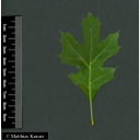
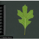
Quercus ilicifolia Wangenh. 1787
Fagaceae
(APG IV)scrub oak, bear oak
Taxon concept: The Plant List (2014), version 1.1
Distribution: northeastern United States
Quercus ilicifolia Wangenh. - Accepted: Quercus ilicifolia Wangenh. bei The Plant List (2014), version 1.1; Familie: Fagaceae (APG III)
- Flowers
- monoecious
- Flower ecology
- wind-pollinated (anemophilous)
- Life form
- shrub or small tree
- Leaves
- alternately arranged leaves
- Foliage persistence
- deciduous
- Fruits
- acorns with saucer-shaped cup
- Fruit ecology
- animal-dispersed (zoochorous) (by birds and small mammals)
- Soil conditions
- preferentially on sandy, rocky, well-drained, nutrient-poor soils
- Root type
- taproot
- Natural occurrence (habitat)
- mixed oak-pine forests (with pitch pine [Pinus rigida])
- Vegetation typ and synecology (plant community)
- mixed deciduous forests
- Altitudinal higher limit (sea level in m)
- 1,000
Erhardt, W., Götz, E., Bödeker, N. & Seybold, S. (2008): Der große Zander. Enzyklopädie der Pflanzennamen. Band 2. Arten und Sorten. Eugen Ulmer KG, Stuttgart (Hohenheim), 18. Aufl., 2103 S.; The International Plant Names Index (2009). Published on the Internet http://www.ipni.org; Courtesy to IPNI, 2009. Exported from IPNI at date: 2009-09-22 20:17:51;
Diese Webseite verwendet Google Maps, um Karten und Standorte von Pflanzen in den Hohenheimer Gärten anzuzeigen. Dadurch werden unter Umständen Daten an Google weitergeleitet, was mit einer Verarbeitung Ihrer personenbezogenen Daten verbunden sein kann. Die Datenschutzerklärung von Google finden Sie hier: Datenschutzerklärung von Google
| Sex | Standort | Accession number | Planting year | Donation | IPEN | Lat. | Long. |
|---|---|---|---|---|---|---|---|
| Parzelle K | EG-K-033-18225 | 1997 | XX-0-HOH-EG-K-033-18225 | 48,7099050113 | 9,2086282135 | ||
| Parzelle T | LG-T-042-18226 | 1998 | + | XX-0-HOH-LG-T-042-18226 | 48,7059580802 | 9,2124536847 |


