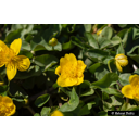
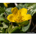
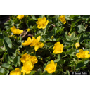
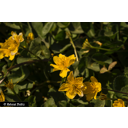
Useful information about the taxon (species, subspecies, variety...)
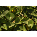
Caltha palustris L. 1753
Ranunculaceae
(APG IV)Akzessionnummer: SYS-17374
Pflanzjahr: 2024
Taxon concept: The Plant List (2014), version 1.1
Caltha palustris L. - Accepted: Caltha palustris L. bei The Plant List (2010); Familie: Ranunculaceae (APG III)Caltha palustris L. - Accepted: Caltha palustris L. bei The Plant List (2014), version 1.1; Familie: Ranunculaceae (APG III)Caltha palustris L. - Accepted: Caltha palustris L. bei The Plant List (2010); Familie: Ranunculaceae (APG IV)Caltha palustris L. - Accepted: Caltha palustris L. bei Schmeil-Fitschen 2019; Familie: Ranunculaceae (APG IV)Caltha palustris L. - Accepted: Caltha palustris L. bei BfN Checklist Flora DE; Familie: Ranunculaceae (APG IV)Caltha palustris L. - Accepted: Caltha palustris L. bei The Plant List (2014), version 1.1; Familie: Ranunculaceae (APG IV)Caltha palustris L. - Accepted: Caltha palustris L. bei World Flora Online - APG IV (Angiosperms); Familie: Ranunculaceae (World Flora Online - APG IV (Angiosperms))
- Color of flower
- yellow
- Life form
- herbaceous, terrestrial, perennial
Breunig, T. et al. (2021): Rote Liste der Farn- und Blütenpflanzen Baden-Württembergs.; Bundesamt für Naturschutz (BfN) (1999-2001 and ongoing): Floraweb - Daten und Informationen zu Wildpflanzen und zur Vegetation Deutschlands. www.floraweb.de.; Erhardt, W., Götz, E., Bödeker, N. & Seybold, S. (2008): Der große Zander. Enzyklopädie der Pflanzennamen. Band 2. Arten und Sorten. Eugen Ulmer KG, Stuttgart (Hohenheim), 18. Aufl., 2103 S.; Martin Nebel et al. (1990): Die Farn- und Blütenpflanzen Baden-Württembergs Band 1. 1. Eugen Ulmer, Stuttgart 3-8001-3309-1.; Maurizio, Anna et al. (1982): Nektar und Pollen - die wichtigsten Nahrungsquellen der Honigbiene. 4. Ehrenwirth, München, 3, überabeitete Auflage; Metzing, D. et al. (2018): Rote Liste und Gesamtartenliste der Farn- und Blütenpflanzen (Trachaeophyta) Deutschlands .; Ministerium für Ernährung, Landwirtschaft, Umwelt und Forsten, Baden-Württemberg (Hrsg.) (1985): Pflanzenkatalog zur Verbesserung der Bienenweide und des Artenreichtums (Kurztitel: Bienenweidekatalog); Oberdorfer, E. (2001): Pflanzensoziologische Exkursionsflora. Für Deutschland und angrenzende Gebiete. Eugen Ulmer Verlag, Stuttgart, 8., stark überarb. u. erg. Aufl, 1056 S. 978-3-8001-3131-0.; Pritsch, Günter et al. (1985): Bienenweide.. Neumann-Neudamm, Melsungen; Pritsch, Günter et al. (2007): 200 Trachtpflanzen erkennen und bewerten.. Kosmos, Stuttgart; Schick, B. & Spürgin, A. (1997): Die Bienenweide. Eugen Ulmer Verlag, Stuttgart, Auflage: 4., völlig neubearb. u. erw. A., 216 S. 978-3800174188.;
Diese Webseite verwendet Google Maps, um Karten und Standorte von Pflanzen in den Hohenheimer Gärten anzuzeigen. Dadurch werden unter Umständen Daten an Google weitergeleitet, was mit einer Verarbeitung Ihrer personenbezogenen Daten verbunden sein kann. Die Datenschutzerklärung von Google finden Sie hier: Datenschutzerklärung von Google

