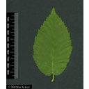
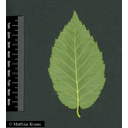
Useful information about the taxon (species, subspecies, variety...)
Betula alleghaniensis Britton 1904
Betulaceae
(APG IV)Yellow birch
Taxon concept: The Plant List (2014), version 1.1
Betula alleghaniensis Britton - Accepted: Betula alleghaniensis Britton bei Zander 2008; Familie: Betulaceae (Zander 2008)Betula alleghaniensis Britton - Accepted: Betula alleghaniensis Britton bei The Plant List (2014), version 1.1; Familie: Betulaceae (APG III)
- Life form
- tree
- Natural occurrence (habitat)
- spruce-fir-hardwood forests, narrow, deep ravines
- Vegetation typ and synecology (plant community)
- temperate mixed mesophytic forests
- Usage
- wood is used in the manufacture of furniture, cabinets, boxes, and paneling; also used as firewood
Diese Webseite verwendet Google Maps, um Karten und Standorte von Pflanzen in den Hohenheimer Gärten anzuzeigen. Dadurch werden unter Umständen Daten an Google weitergeleitet, was mit einer Verarbeitung Ihrer personenbezogenen Daten verbunden sein kann. Die Datenschutzerklärung von Google finden Sie hier: Datenschutzerklärung von Google
| Sex | Standort | Accession number | Planting year | Donation | IPEN | Lat. | Long. |
|---|---|---|---|---|---|---|---|
| Parzelle U | LG-U-051-18890 | 1998 | + | XX-0-HOH-LG-U-051-18890 | 48,7074117829 | 9,2126465277 | |
| male and female flowers on the same individual | Parzelle E | SP-EB-086-1412 | 2014 | XX-0-HOH-SP-EB-086-1412 | 48,7107949292 | 9,2118639469 | |
| Parzelle E | SP-EB-083-15613 | 2012 | XX-0-HOH-SP-EB-083-15613 | 48,7108896779 | 9,2116857026 | ||
| male and female flowers on the same individual | Parzelle E | SP-EB-047-16395 | 2015 | XX-0-HOH-SP-EB-047-16395 | 48,711027038 | 9,2117542731 | |
| Parzelle E | SP-EB-048-16405 | 2015 | XX-0-HOH-SP-EB-048-16405 | 48,7107942413 | 9,2118028115 | ||
| male and female flowers on the same individual | Parzelle K | SP-KB-048-15889 | 1999 | XX-0-HOH-SP-KB-048-15889 | 48,7108931768 | 9,214838521 |


