Useful information about the taxon (species, subspecies, variety...)
Betula pumila L. 1767
Betulaceae
(APG IV)bog birch, dwarf birch, low birch, shrub birch, swamp birch
Akzessionnummer: EG-L-033-20032
Pflanzjahr: 1953
Taxon concept: The Plant List (2014), version 1.1
Distribution: Canada; USA: northeastern, northeast-central, North Dakota, Montana
Size: 1 - 4 (m)
Betula pumila L. - Accepted: Betula pumila L. bei Zander 2008; Familie: Betulaceae (Zander 2008)Betula pumila L. - Accepted: Betula pumila L. bei The Plant List (2010); Familie: Betulaceae (APG III)Betula pumila L. - Accepted: Betula pumila L. bei The Plant List (2014), version 1.1; Familie: Betulaceae (APG III)Betula pumila L. - Accepted: Betula pumila L. bei The Plant List (2010); Familie: Betulaceae (APG IV)Betula glandulifera (Regel) B. T. Butler - Synonym: Betula pumila L. bei Zander 2008; Familie: Betulaceae (Zander 2008)
- Life form
- shrub
- Leaves
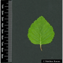
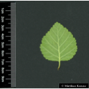
- margin coarsely dentate
- Foliage persistence
- deciduous
- Fruits
- winged nut (samara)
- Natural occurrence (habitat)
- sphagnum bogs, fens, muskegs, streamsides and lakeshores
- Constraints according radiation (light)
- intolerant of shade
Schönfelder, P. (2011): Das neue Handbuch der Heilpflanzen.. Franckh-Kosmos Verlags-GmbH & Co. KG, Stuttgart: 502. 978-3-440-12932-6.;
Diese Webseite verwendet Google Maps, um Karten und Standorte von Pflanzen in den Hohenheimer Gärten anzuzeigen. Dadurch werden unter Umständen Daten an Google weitergeleitet, was mit einer Verarbeitung Ihrer personenbezogenen Daten verbunden sein kann. Die Datenschutzerklärung von Google finden Sie hier: Datenschutzerklärung von Google


